Nitara Radar: Solving the real-time discovery gap in rural dairy farming
By Akshat JainAug 11, 2026
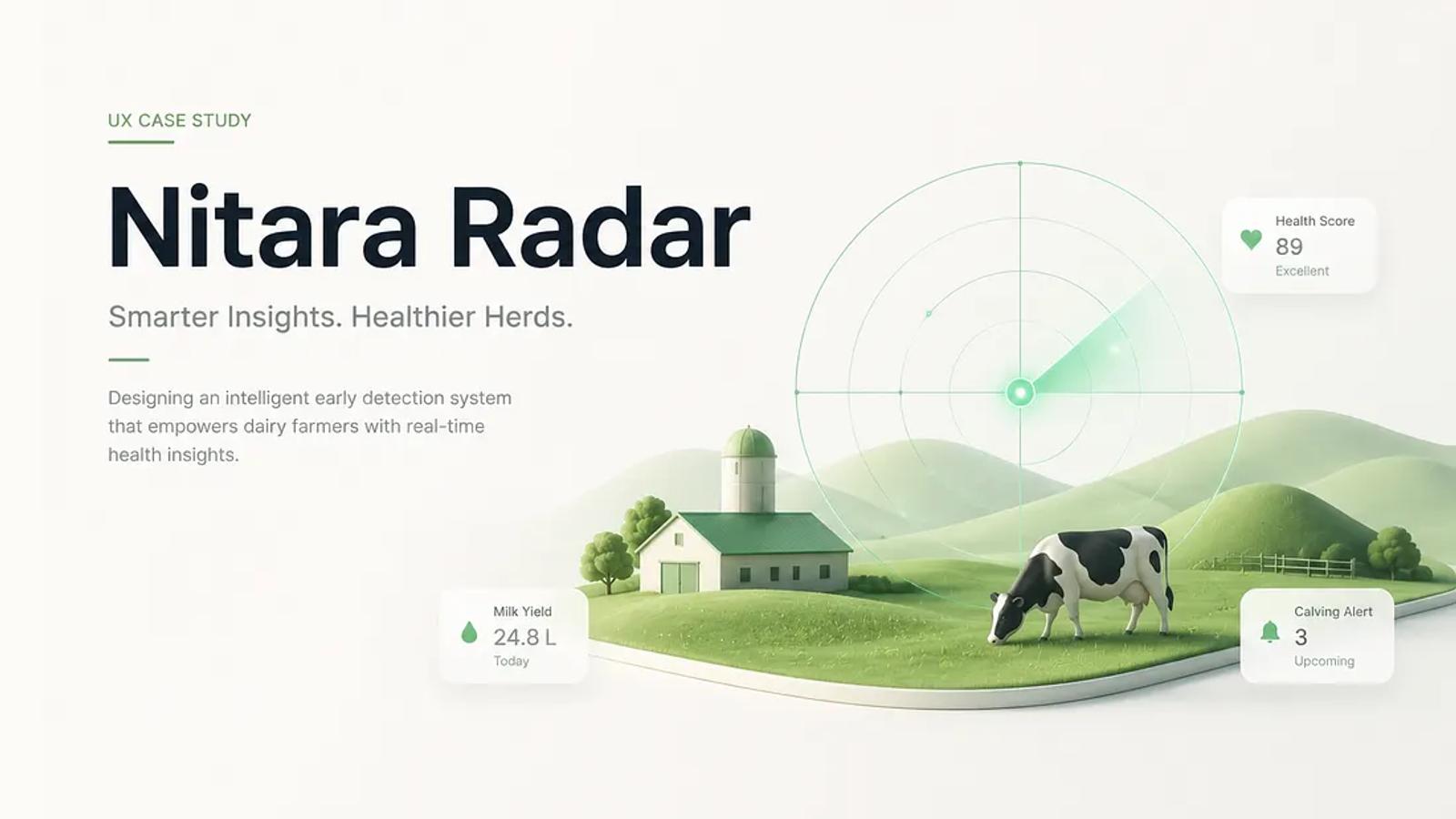
In precision dairy farming, operational timing directly impacts productivity and farm profitability. Biological deadlines, specifically the heat cycle in cattle, present a critical 12 to 18-hour window for successful Artificial Insemination (AI). Failing to service an animal within this window forces a 21-day delay until the next heat cycle, compounding into unrecoverable milk yield loss, added feed expenses, and reduced annual revenue for smallholder farmers.
Despite the critical nature of these care windows, rural veterinary delivery has historically relied on reactive phone calls and word-of-mouth discovery. To address this structural inefficiency, we developed Nitara Radar, a localized, anchor-based service broadcast feature integrated across the Nitara ecosystem (Nitara Farmer App and Nitara Service Provider App).
Here is an inside look at how we designed Nitara Radar to transition rural livestock care from reactive scheduling to proactive, location-anchored service delivery.
The product mechanism: Static spatial anchoring vs. Continuous GPS tracking
When designing location-aware features for rural infrastructure, continuous real-time GPS tracking introduces major bottlenecks: severe battery drain, high data payload overhead, and frequent signal loss over unstable 2G/3G networks.
To overcome this, Nitara Radar operates on a Static spatial anchor model:
- Activation point: When a Service Provider (SP) arrives at a specific location, such as a central village hub or a local dairy cooperative, they activate Radar from that static position.
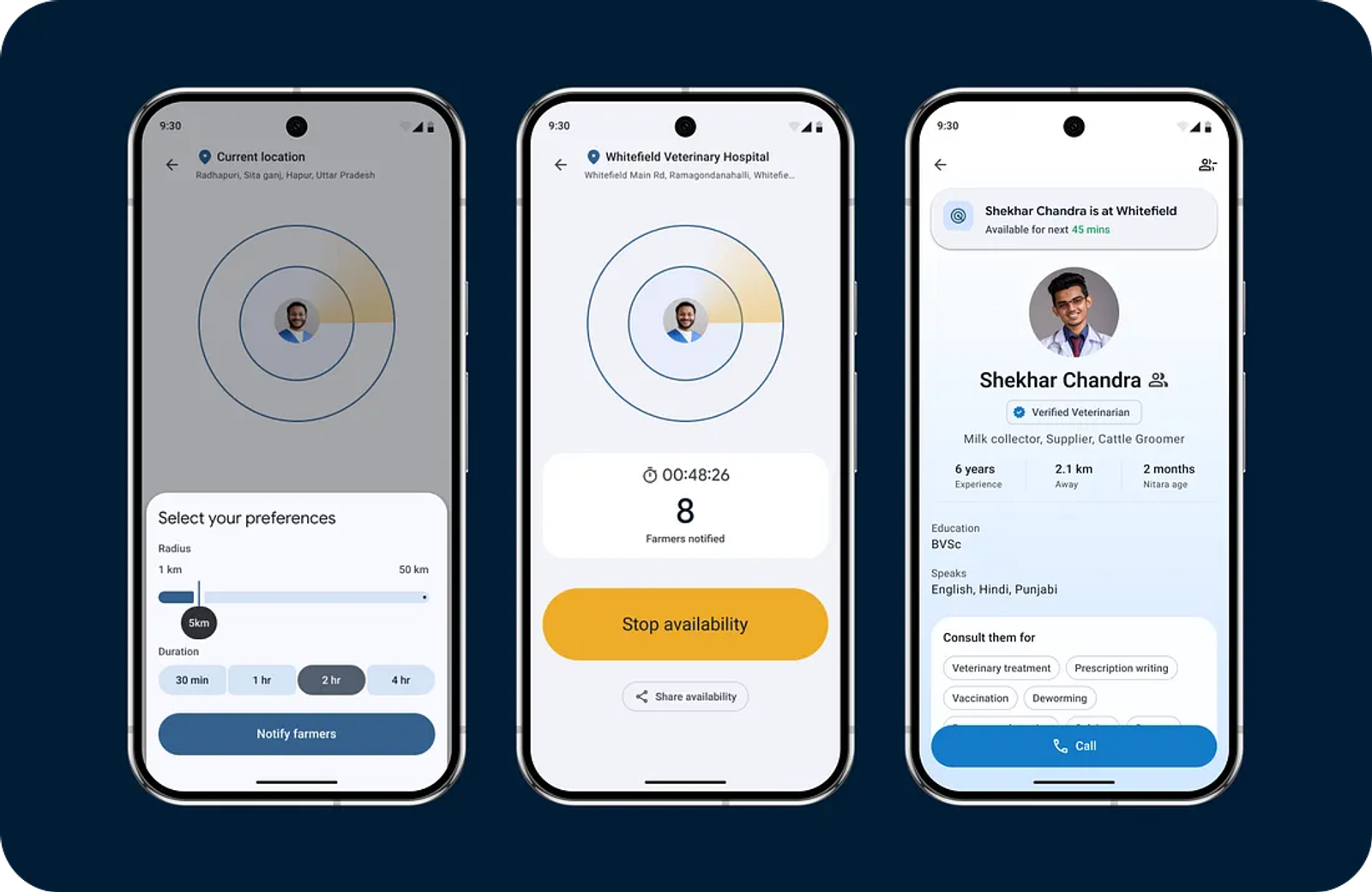
- Fixed radius & time window: The SP selects a coverage radius (e.g., 3 km, 5 km) centered on their current activation point, along with an active duration (e.g., 1 hour, 2 hours).
- Stationary geofence: The system establishes a fixed circular geofence around that origin point for the duration set by the SP. The boundary remains stationary and does not continuously track or update with the SP’s movement, preserving device resources and network bandwidth while creating a predictable window of availability.
Core product applications & value delivered
Use case: Targeted demand capture at village clusters
- Problem statement: Critical dairy interventions (AI, heat management, and emergency health checks) require rapid turnaround. Delays caused by poor provider visibility result in missed biological windows.
- Nitara Radar contribution: Upon setting a Radar anchor at a village stop, the platform queries all registered Nitara Farmer accounts falling within that static radius. It triggers targeted push notifications informing farmers that an expert is stationed nearby for the specified time window, allowing farmers with urgent cattle needs to dispatch immediate requests.
Battery-efficient & low-bandwidth operation - Problem statement: Continuous location polling in rural areas quickly drains technician smartphone batteries and fails in low-connectivity zones, rendering live-tracking systems unreliable.
- Nitara Radar contribution: By decoupling the broadcast from real-time movement, Radar requires only a single location payload at the moment of activation. Once the static geofence is registered on the server, no ongoing telemetry streaming is required from the SP’s device, ensuring 100% operational reliability even in weak network pockets.
Zero-friction service call for farmers
- Problem statement: Multi-step booking forms and complex mobile navigation slow down service requests, particularly in regions with varying levels of digital literacy.
- Nitara Radar contribution: Nitara Radar streamlines interaction down to a single-tap workflow. Clicking the proximity alert opens a high-visibility status card displaying the provider’s credentials, the active location anchor, remaining availability time, and a direct call button.
Operational challenges and strategic next steps
As adoption of Nitara Radar continues to scale across our active rural hubs, our engineering and product teams are focusing on three key enhancement areas:
- Optimal radius defaults: Analyzing historical farm density per district to automatically recommend the ideal broadcast radius to SPs upon activation.
- Anchor expiration reminders: Providing automated push prompts to service providers prior to their Radar session expiring, allowing them to extend their anchor duration or log a new location if they relocate to an adjacent cluster.
- Quality of service metrics: Tracking request fulfillment rates and conversion speed per anchor point to continually evaluate the impact of static broadcasting on overall veterinary access.
Visit our website for more details: Innovations | NITARA — AI-Powered Dairy Technology | Nitara
Related articles

Building Nitara: The 5 Hardest Problems We Solved in Indian Dairy ; And the Ones We’re Solving Next
Amee DesaiSep 16, 2026
Read article
PocketVet: Rebuilding Veterinary Care for Rural India
Nidhi JaikumarAug 18, 2026
Read article
My Cashbook: Streamlines financial tracking for dairy service providers
Akshat JainAug 18, 2026
Read article